What will the new base area look like? We’re working on a gallery of maps to give you a good idea. If you have Google Earth, you can view these maps as 3D overlays using our Base Area Overlays .kml file.
Two Possible Visions
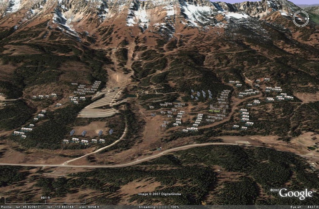
The following image shows BMV at maximum buildout, with overnight accommodations in large, dispersed 6- to 8-unit condos and homes at the upper limits specified by proposed design guidelines (9,000 to 10,000 sq ft). A large lodge at the proposed second base area houses roughly 100 units plus commercial amenities. Corresponding lift infrastructure is not shown. Generally the light-colored roofs are homes, while the darker roofs are multi-unit overnight accommodations. This is not BCP’s plan per se; it is just one scenario of a permissible arrangement if the current application were approved as is. The original application did not specify the configuration of units after phase 1. The original phase 1 specified 1- to 4-unit overnight accommodations; if that approach were generally pursued, the overnight structures would be smaller but much more numerous. The large scale of the buildings means that they contain on the order of 1.5 million square feet – roughly 15 Costcos. Their dispersed nature means that a large portion of the land in the base area is impacted visually and environmentally.
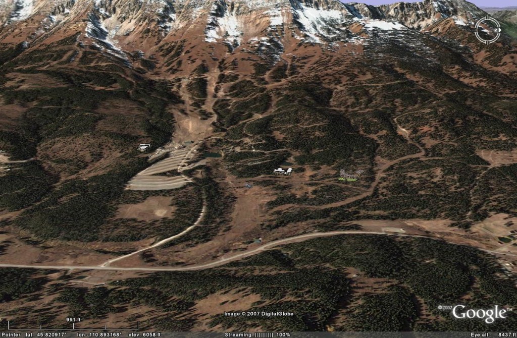
The next image shows the same number of units, but with all structures attached and concentrated into three lodge structures. The square footage of recreational homes and overnight accommodations is reatly reduced to match typical hotel rooms and townhomes. As a result, the total footprint of the development is much less. While this may not be an economically viable configuration, it indicates how much more of the base area’s natural assets could be preserved while still serving skiers.
BCP Base Area Development Master Plan
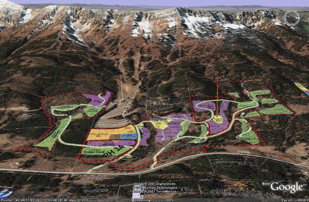
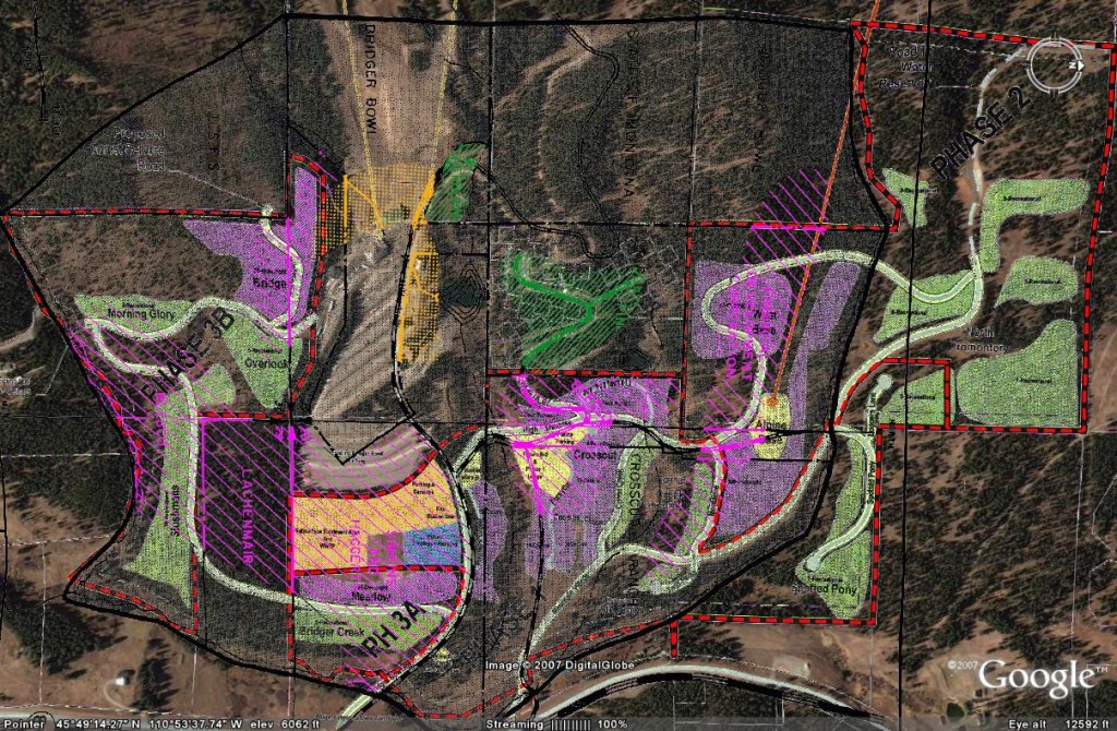
The following view, looking West toward the Bridgers, shows BCP’s proposed development overlaid on the existing terrain. The dashed red line shows property and development phase boundaries. Purple shaded areas are overnight accommodations, green is recreational housing, yellow is commercial, and yellow-orange is utilities (fire station, wastewater treatment, etc.). The existing Bridger Bowl base is visible just left of center, above the parking lot. To the right (north) lies the Bridger Pines subdivision. The overlay is Map 1A from the BCP PUD application.
Phase 1
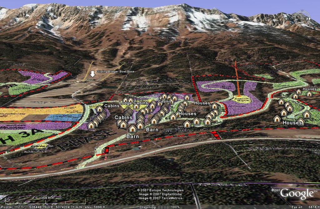
Phase 1 of Bridger Mountain Village, with approximate placement of structures shown. There are about 80 cabins, recreational homes, a lodge, and other structures (including a fire station and sewer plant, not shown). In April BCP amended its application to remove 21 of the cabins and the equestrian barns in the lower meadow, moving roads accordingly. With that change, there might be fewer structures, or they might be relocated. The Planning Dept. Staff Report indicates that cabins may have detached garages up to 500 square feet, which would considerably increase the number of structures shown. This image also gives a good view of the proposed second base area lift (Phase 2), which starts at the Alpine Base area, in yellow, right of center. That lift primarily serves Bridger Mountain Village, as there is no public parking at the second base. It’s unclear where the new lift would terminate, but given its orientation it would lie somewhere north of the Alpine lift, perhaps serving Bradley Meadows, or connecting to Bridger’s proposed N1 lift.
Bridger Canyon Zoning District Base Area Development Plan
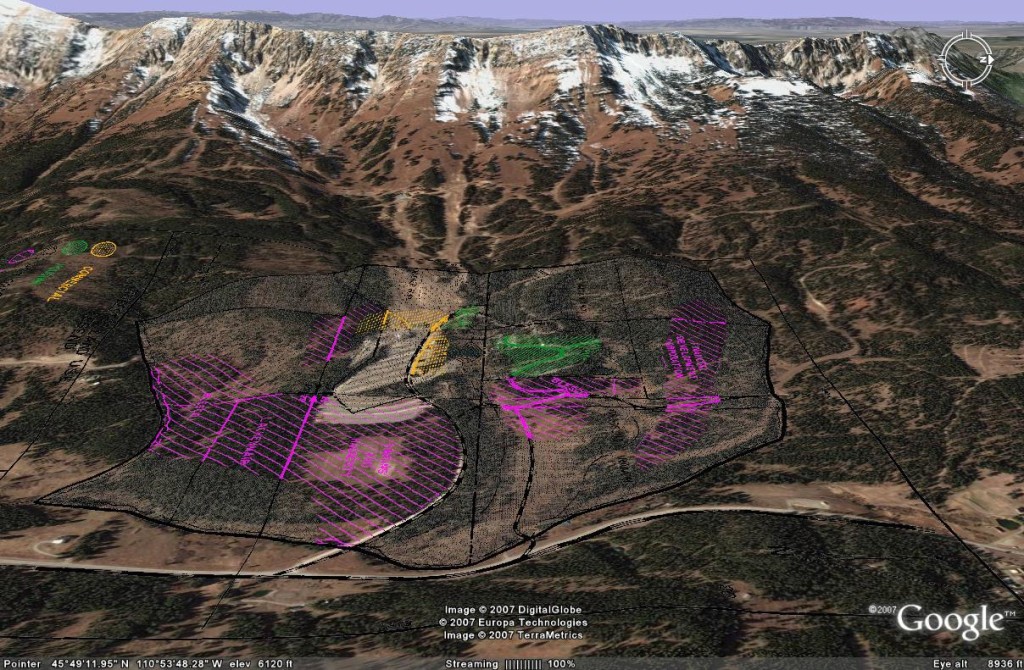
The following view shows recommended land use from the base area development plan (one of our key zoning district documents). Green is housing, pink is overnight accommodations, yellow is commercial, and the remaining shaded area is recreational use. Notice that the development pattern is more concentrated and avoids almost all of the meadow north of the access road.



 Twitter
 Facebook
 RSS
RSS Email
Email