Monthly Archives: April 2013

Variance Hearing

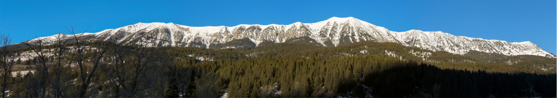
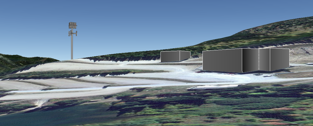
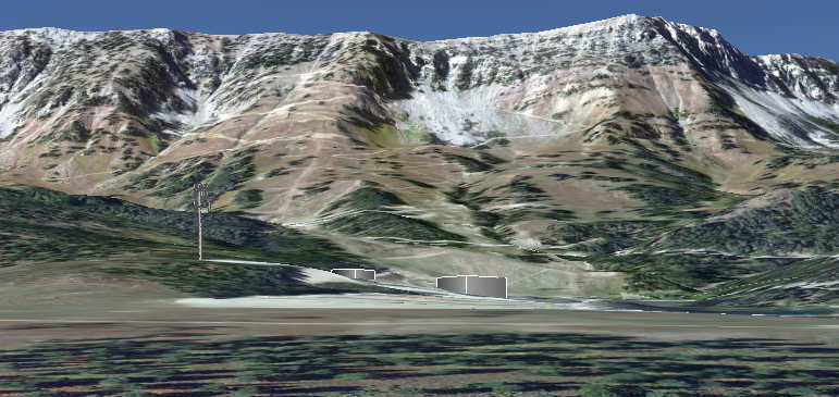
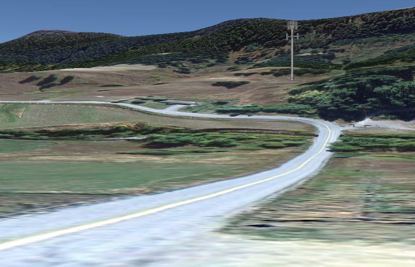
This Thursday, April 11, there will be a Planning & Zoning Commission hearing for a variance to enable conversion of two barns to residential use. The variance is required because the structures lie well inside the 100-foot setback from Bridger Creek. This makes the structures, which predate zoning, nonconforming, and therefore it is not permissible to substantially alter them and change their use.

Sadly, this is another tale of “build first and ask for forgiveness.” Construction commenced without permits, in spite of written notice from the Planning Department that permits were required. The Commission has again failed to take any meaningful enforcement action. This is hard to understand, because the Commission has recently taken enforcement action against other landowners for less serious violations, and is ignoring the very precedent that it spent our tax dollars to set in the MT Supreme Court in the Theken barn case.

This is the second time this variance has come up for review; the first was in January. BCPOA unanimously opposed the variance then, and now. Testimony from the January hearing is in BCPOA comment Petty CUP 2013-01-09.

The plain language of the zoning states that a variance may be granted only when, due to special circumstances of the property, strict application of the zoning deprives a landowner of privileges that others enjoy. In this case, there is no such deprivation, because the property has several acres of buildable land outside of setbacks. Therefore the letter of the law should prevail and the stream setback should be respected.

If you wish to express your opinion on this matter, you can attend Thursday’s hearing, or send a brief note to the Bridger Canyon Planning & Zoning Commission regarding the Petty Variance, at planning@gallatin.mt.gov.

The following memo details problems with permitting and enforcement of the project to date:

BCPOA-Petty 2013-04-09

BCPOA-Petty 2013-04-09 Exhibits 1-10

BCPOA-Petty 2013-04-09 Exhibit 11 Theken decision

Testimony for the upcoming hearing will be posted here as it becomes available.

BCPOA-Petty 2013-04-09
BCPOA-Petty 2013-04-09 Exhibits 1-10
BCPOA-Petty 2013-04-09 Exhibit 11 Theken decision

BCPOA comment Petty variance 2013-04-11

BCPOA comment Petty variance 2013-04-22

[google-map-v3 width=”350″ height=”350″ zoom=”12″ maptype=”hybrid” mapalign=”center” directionhint=”false” language=”default” poweredby=”false” maptypecontrol=”true” pancontrol=”true” zoomcontrol=”true” scalecontrol=”true” streetviewcontrol=”true” scrollwheelcontrol=”false” draggable=”true” tiltfourtyfive=”false” addmarkermashupbubble=”false” addmarkermashupbubble=”false” addmarkerlist=”10600 Bridger Canyon Rd, Bozeman MT 59715{}1-default.png{}Petty CUP & Variances” bubbleautopan=”true” showbike=”false” showtraffic=”false” showpanoramio=”false”]

Possible Cell Tower Appearance

Update: Atlas Towers’ renditions are at http://zoning.posterous.com/atlas-cell-tower-mockups

Here are some very rough renderings of cell towers at locations currently under discussion. Bear in mind that these are probably worst-case, as tower heights are likely to be lower. The renderings do not represent tree cover, which would reduce the appearance of height, though neither location offers dense tree cover. A stealth tower design and smaller antenna arrays could also reduce the visual impact.

“Bridger Ski” tower

Bridger Bowl, with a 130′ tower just south of the propane tank in A lot. Very rough envelopes of the Saddle Peak lodge and ski patrol building shown for scale.

As seen from Bridger Pines, looking across the base area:

BridgerSkiFromBP

As seen from the entrance off Hwy 86:

BridgerSkiFromEntry

“Bridger South” tower

A 150′ tower on the Brunner property, at the bottom of Kelly Canyon. I placed this about halfway upslope on the narrow parcel, though the actual location is not known to me.

From the Schoolhouse:

BridgerSouthFromSchoolhouse

From Kelly Canyon at the Bridger Woods Rd. turnoff:

BridgerSouthFromKellyBW

Bridger South – Taller

Update: There are conflicting reports about the location of the South tower needed for connectivity. If the tower would have to be tall enough to see over the ridge to the south, it would look more like the following:

BridgerSouthFromSchoolhouse2

Tree cover would conceal the bottom portion of the tower, possibly diminishing the impression of height. But it would be difficult to maintain tree cover with foundations, roads and other site improvements on steep slopes.

[google-map-v3 width=”350″ height=”350″ zoom=”12″ maptype=”hybrid” mapalign=”center” directionhint=”false” language=”default” poweredby=”false” maptypecontrol=”true” pancontrol=”true” zoomcontrol=”true” scalecontrol=”true” streetviewcontrol=”true” scrollwheelcontrol=”false” draggable=”true” tiltfourtyfive=”false” addmarkermashupbubble=”false” addmarkermashupbubble=”false” addmarkerlist=”45.816051° -110.894324°{}1-default.png{}Proposed cell tower at Bridger Bowl|45.692992° -110.927496°{}1-default.png” bubbleautopan=”true” showbike=”false” showtraffic=”false” showpanoramio=”false”]

Possible Cell Tower Coverage

Last week, Atlas Towers representative Tierney Rowe met (separately) with Bridger Bowl’s board and BCPOA directors. There is not currently a proposal before the commission, but discussions are progressing. The following coverage maps are one product.

Hi Folks, these are .jpgs which you can download and then zoom into, showing the various types of coverage that the towers currently proposed by Atlas Towers would accomplish.

There are two proposed sites, one at Bridger Bowl called BridgerSki and the other at the Brunners’ property [in Kelly Canyon] called BridgerSouth.

Each individual site has two propagation maps representing coverage by 850 MHZ or 1900 MHZ. Apparently each frequency has pros and cons so they are mixed for best results.

Then there are two “composite” maps that show coverage over the entire Canyon with Bridger Ski and Bridger South coverage mixed, at each frequency. Not sure why we didn’t get a map that shows both frequencies together over the entire canyon.

Remember that these maps are based on a 130′ tower at Bridger Bowl and a 150′ tower at the Brunners. Clearly, the taller the tower, the better the coverage. I understand from several sources that the BB Board is not considering the 130′ tower and wants to see something in the 60′ range. And I think it fair to say that an 150′ tall tower at the Brunners would elicit considerable local concern.

That being said, when you look at these propagation maps keep in mind this is a best possible scenario which is based on tower heights that are very unlikely to happen. [In particular, the 130′ tower at Bridger Bowl was a no-go with the board.] Hence, coverage will be less complete than what is shown. See Tierney’s comment below about tower height.*

Kent Madin

* “The primary goal is good coverage and tower height directly correlates to the quality and density of coverage in these locations where terrain issues place limitations on signal transmission.”

Composite850mhz Composite1900mhz

Composite coverage maps at 850 and 1900 MHz. Click to enlarge.

Update: Overlays of the coverage map with zoning district boundaries (blue), parcel lines (yellow) and structures (orange dots).

850MHz:

CoverageOverlay850mhz

1900MHz:

CoverageOverlay1900mhz