Base Area Zoning History FAQ
Excerpted from Kate Vargas’ testimony on the Bridger Mountain Village PUD application.
- What was the intention behind creating a zoning district, development guides, and zoning regulations?
- How and why was a separate plan for the base area developed?
- Why was the base area allotted the high density PUD allocation of one unit per half acre, unprecedented elsewhere in the canyon?
- If Bridger Bowl was to provide overnight accommodations, how is it that they’re now allowed to build single-family homes?
- What were the lawsuits of the early and mid 1990’s all about and what were the outcomes?
- Didn’t the lawsuits of the mid-1990’s determine what the developers can and cannot build?
- What’s happened since the settlement?
- What guidance does the General Plan give us for evaluating the merit of PUD applications in the base area?
- How about evaluative criteria in the Base Area Plan?
- What specific direction does the Bridger Canyon Zoning Regulation provide?
What was the intention behind creating a zoning district, development guides, and zoning regulations?
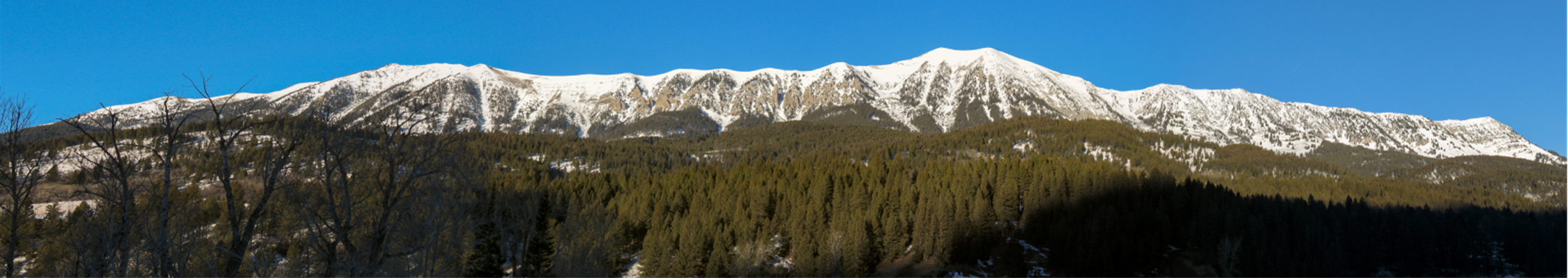
In order to preserve the “natural, physical character of the canyon, and to ensure orderly growth,” the residents of Bridger Canyon petitioned for a development plan that was adopted in 1971. The main reason for this interest in a development plan was a shared concern about the growth of Bridger Bowl and its impact on traffic along Bridger Canyon Road. In that same year, the Bridger Canyon Zoning District was created as Montana’s first zoning district and the Bridger Canyon Zoning Regulation was approved. Simply put, the residents of Bridger Canyon created a zoning district and the accompanying plans and regulations “to guide future physical growth within Bridger Canyon and to protect the natural beauty and agricultural open space character of the area” (p. 2).
How and why was a separate plan for the base area developed?
In response to “various development requests” (p. 2) the Bridger Bowl Base Area Conceptual Plan was prepared (with input from consultants hired by both the County Commission and Bridger Canyon residents) and adopted by the Planning and Zoning Commission in 1979. This plan was designed to be an “extension” of the General Plan (Base Area Plan p. 6), and “to guide [any] development that may take place in the base area” (p. 23). (At that time [as is the case presently] expansion of Bridger Bowl was “not a priority” (p. 20) and the need for development in the base area was unclear.)
In October 1985, the Bridger Bowl Base Area Plan was adopted, updating and replacing the Conceptual Plan. Specifications for a base area PUD were incorporated into the Zoning Regulation at this time.
Why was the base area allotted the high density PUD allocation of one unit per half acre, unprecedented elsewhere in the canyon?
The General Plan recognized the recreational potential of Bridger Bowl and estimated that it could expand to include 7000-8000 skiers. Planners and residents were very concerned that the existing highway would not be able to handle traffic generated by that many skiers. Constructing a four-lane roadway that could handle such traffic was considered contradictory to the intent of the General Plan. As a means of resolving this expected future traffic problem, the plan allowed for a high density PUD in the base area of one overnight unit per half acre (two density units per acre or a total of 800 units) if an acceptable PUD application was approved.
This goal of traffic alleviation is reiterated in the 1979 Bridger Bowl Base Area Conceptual Plan and the current Bridger Bowl Base Area Plan. Both state that “the rationale for creating this high density allocation with overnight qualification (the balance of the Bridger Canyon area has an allowable PUD density of only one unit per 20 acres…) was to allow for the expansion of the Bridger Bowl Ski Area to its ultimate capacity without exceeding the vehicular capacity of the two-lane Bridger Canyon Road” (p. 1 Conceptual Plan; p. 3 Base Area Plan). The purpose of the high density PUD allowance in the base area, then, was to solve a traffic problem for canyon residents that was anticipated to occur as Bridger Bowl expanded to its full capacity.
If Bridger Bowl was to provide overnight accommodations, how is it that they’re now allowed to build single-family homes?
In 1989 over the objections of property owners in the canyon, the Commission approved an amendment to the Bridger Canyon Zoning Regulation allowing 25 percent of all existing overnight density rights to be allocated to single family homes, for a total of 182 homes in the base area around Bridger Bowl. This action was based on the assertion that overnight accommodations for Bridger Bowl would never be built unless a developer could be assured a larger profit margin through sales of single-family homes.
What were the lawsuits of the early and mid 1990’s all about and what were the outcomes?
In 1990 and 1991, the Commission approved the annexation of 360 acres (North Slope and Hammersmark properties) into the base area. Shortly thereafter (in 1992), the 360 Ranch Corporation submitted a PUD application for the expanded base area which included a golf course and 151 single family homes. The development was approved in early 1993 over the objections of Bridger Canyon property owners. Shortly thereafter, BCPOA appealed the Commission’s decision.
After being denied in district court in 1994, BCPOA appealed to the Montana Supreme Court. In March of 1995, the Supreme Court ruled in favor of BCPOA and held that “once a General Plan (master or comprehensive plan)…is adopted, the Commission must substantially comply with that planning document” (p. 132).
The court’s action invalidated the 1993 approved master PUD. Because the court also concluded that “the planning documents…should be internally consistent as well as consistent with companion planning documents,” in May of 1995, the Commission attempted to remedy the inconsistencies cited by the Supreme Court by passing a “resolution of intention.” The following month, BCPOA appealed the Commission’s amendments. The suit was settled out of court in November 1996 and was sealed by the presiding judge. In that same year the previously annexed 360 acres (North Slope and Hammersmark) was de-annexed from the base area, thereby reducing the base area to 404 acres. In 1999, the Zoning Regulations were updated to reflect the 1996 settlement agreement, reducing the maximum number of single-family homes 360 Ranch or its successors could build if they could qualify for a PUD; the numbers were reduced from 151 to 50 and the number of density rights on the North Slope property was limited.
The lawsuits may also have pointed out an important concept articulated on page 23 of the Conceptual Plan that “the Planning and Zoning Commission must be extremely careful to not arbitrarily change basic concepts of the plan without a firm basis and a reasonable approach in doing so.”
Didn’t the lawsuits of the mid-1990’s determine what the developers can and cannot build?
The Conceptual Plan answers this question clearly on page 21, “in the…base area the basic density allows one unit per 40 acres as a matter of right, but if an acceptable PUD is presented, a density of up to two units per acres can be obtained.” The 1996 settlement agreement only set the limit on the maximum number of single-family homes the developer who owned the land in question would be allowed to build if his project was deemed meritorious enough for PUD status. In addition, on page 28 of the Base Area Plan, it states that the density bonus that comes with a PUD designation is granted because the developer has proven that the proposed project will provide the district with significant benefits. Further, to gain PUD status, a project must support the purposes of the district, the goals of the base area, and comply not only with the letter of the Zoning Regulations but the intent of the General and Base Area plans. The project should be held accountable for addressing the problems that the PUD was designed to solve. The benefits should be “real” and be meaningful to the district in which it’s located. Finally, in order for it to receive the density bonus, it should provide more benefit to the community than a development following the underlying zoning.
What’s happened since the settlement?
In 2005 Bridger Canyon Partners purchased 345 acres in the base area. The following year, the Commission approved BCP’s request to re-annex the 113-acre North Slope property into the base area. In December of 2006, BCP filed its PUD application for Bridger Mountain Village.
What guidance does the General Plan give us for evaluating the merit of PUD applications in the base area?
In the section considering the base area, the General Plan lists it’s criteria for approving developments: “It is an underlying objective of the canyon residents to support the establishment of recreational uses in harmony with the natural setting, while insisting upon limitation to prevent damaging environmental effects. These limits are designed to prevent any significant change in the environmental character of the canyon. Access control provides the basic limiting element. Any increase in traffic movements, resulting in the need for a four-lane roadway, would be considered a major detriment to the canyon. All proposed development should be reviewed in terms of its…”
1) sensitivity to surrounding uses;
2) influence on water quality;
3) access and traffic generation potential; and
4) overall effects on the environmental quality (p. 30)
In addition to these principles, the General Plan offers specific guidance in various areas throughout the Plan. Pages 25 and 26 speak to building concepts that are “based on the premise of maintaining the existing canyon character as much as possible.” The Design Concepts section starting on page 37 advises developers on community and environmental design and provides an extensive list of design guidelines.
How about evaluative criteria in the Base Area Plan?
On page 6 of the Base Area Plan, it tells us that “this plan attempts to give direction to the expansion of the ski area and accompanying development while preserving the character of Bridger Canyon, and remaining consistent with the basic intent of the Bridger Canyon General Plan….The goals and objectives [of the Plan] provide a broad and basic framework for determining the merits of development proposals.” The goals of the Base Area Plan are to 1) encourage quality year-round recreational activities within the Base Area; 2) Help control traffic with the limits of two-lane Bridger Canyon Road; 3) Conserve the natural resources within the Base Area and Bridger Canyon in general.
What specific direction does the Bridger Canyon Zoning Regulation provide?
On page 28, it tells us that in exchange for the density bonus implicit in a PUD, developers must provide “significant community benefits.” As these benefits (to be at all valuable) must be recognized as beneficial to the district. Fortunately the Zoning Regulations list very clearly our values specifying the purposes of the district. Five of those purposes include the following: 1) enhance and preserve open space and unique natural features; 2) preserve to the maximum extent possible the natural characteristics of the land, including topography, vegetation, streams, and tree cover; 3) protect areas of important wildlife habitat; 4) lessen the visual impact of development and preserve the scenic vistas and rural atmosphere; 5) preserve agricultural lands.


 Twitter
 Facebook
 RSS
RSS Email
Email