The objection period closes on September 8th, 2020 on the proposed Custer Gallatin Forest Plan. During the objection period, people who have previously filed comments have another chance to respond.
The full plan is here: https://www.fs.usda.gov/detail/custergallatin/landmanagement/planning/?cid=fseprd733838
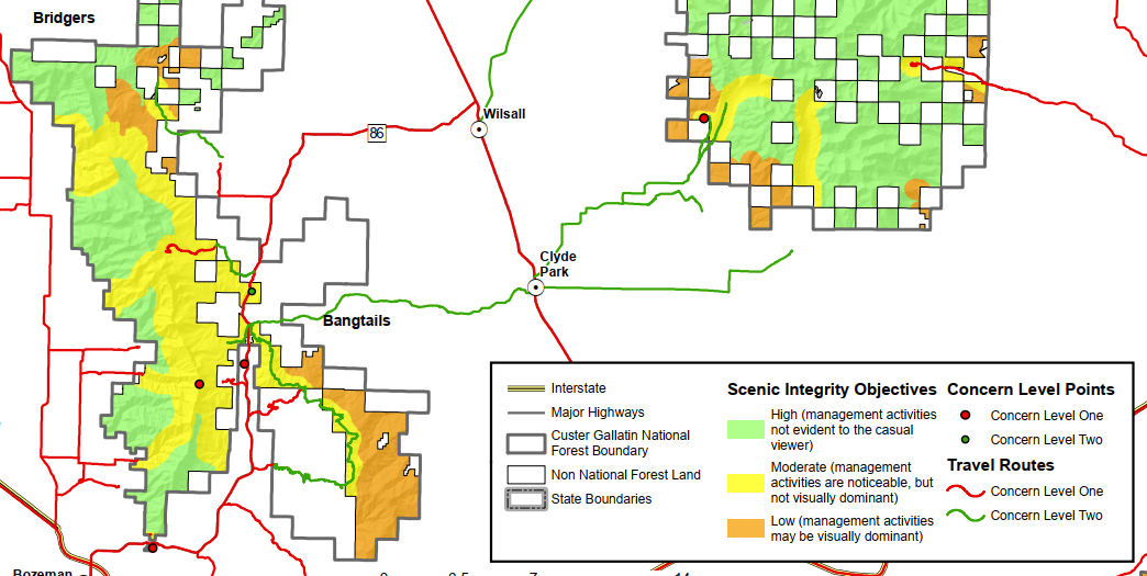
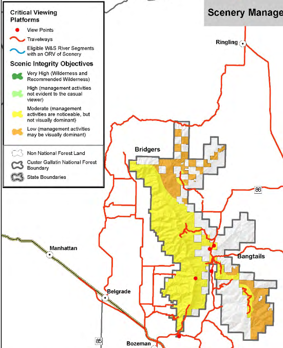
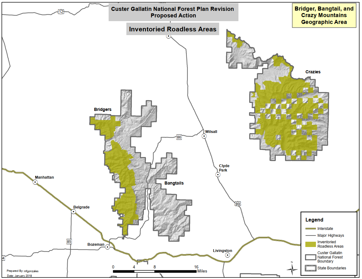
The Bridger/Bangtail section of the document starts on page 158 here: https://www.fs.usda.gov/Internet/FSE_DOCUMENTS/fseprd762990.pdf
Differences
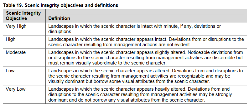
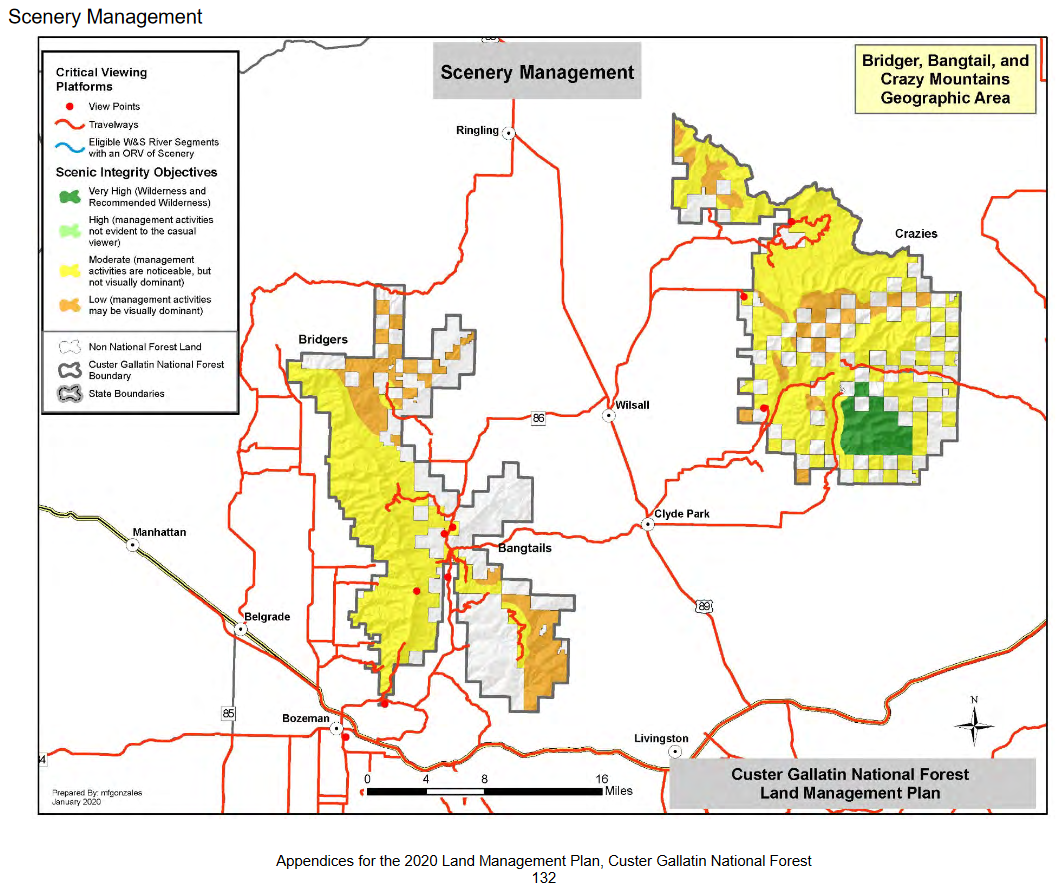
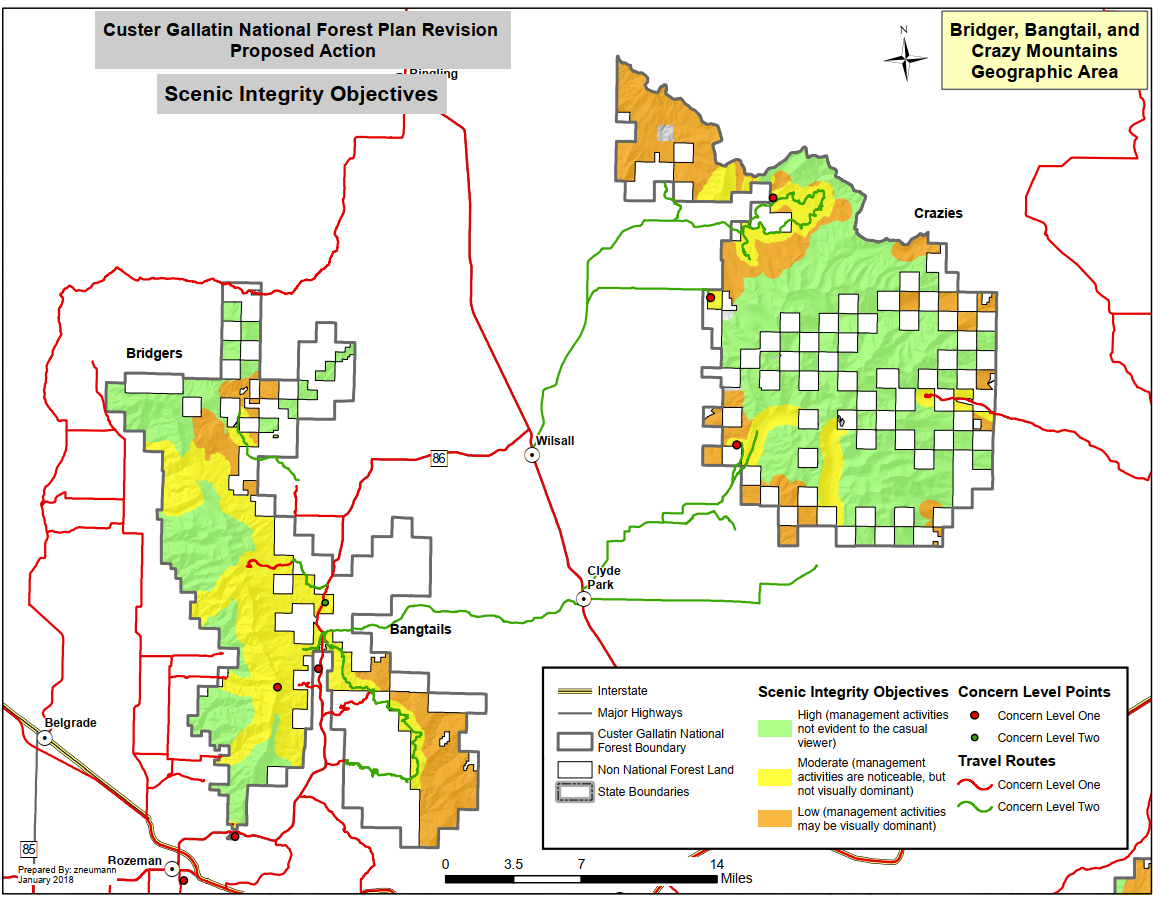
There is at least one substantial change from the 2019 draft. The earlier plan placed substantial portions of the Bridgers in a “high” scenic integrity category. The 2020 draft places most of the range in the “moderate” category.
 I have an inquiry pending about this change, and how to comment.
If you notice other substantial differences, please note them in the comments!
Other excerpts and maps:
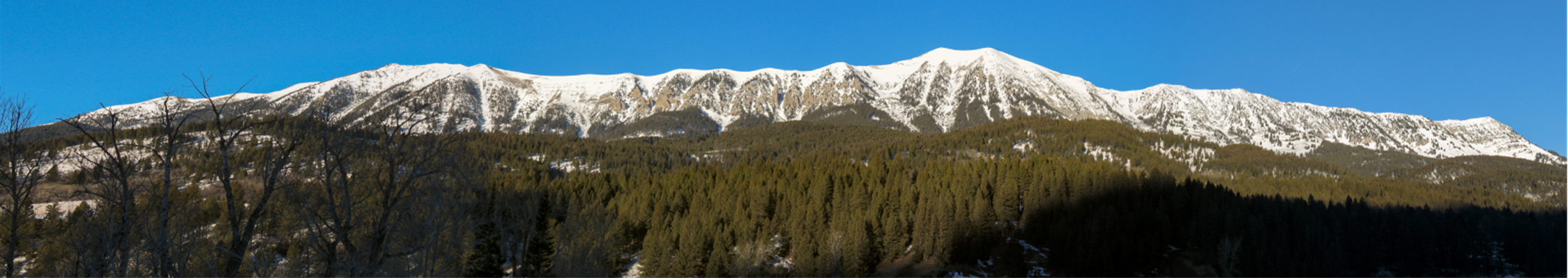
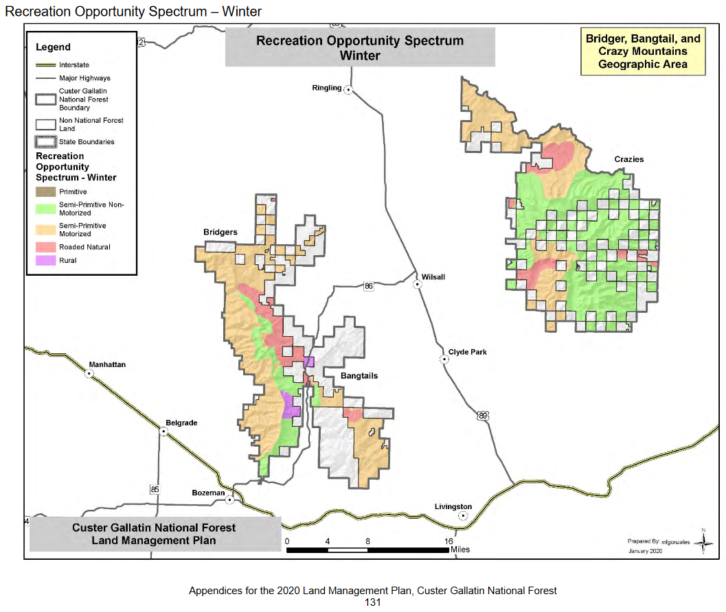
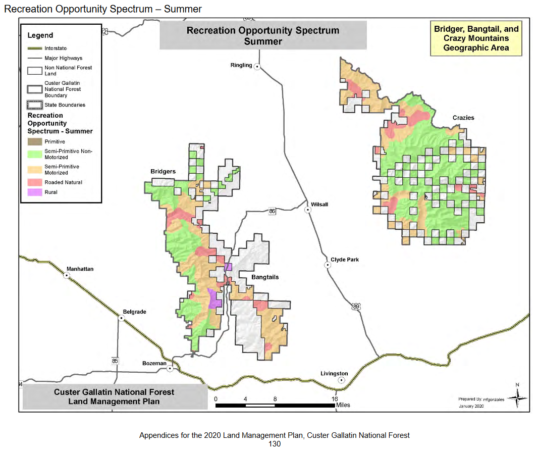
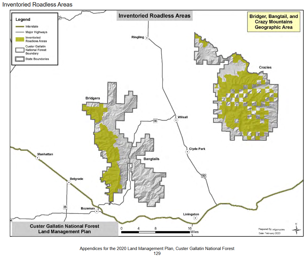
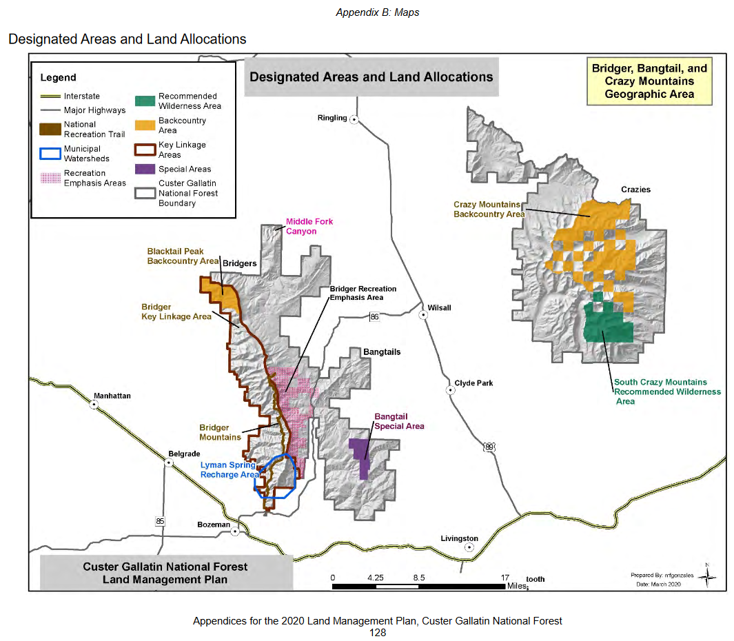
Vision for the Bridger, Bangtail, and Crazy Mountains Geographic Area
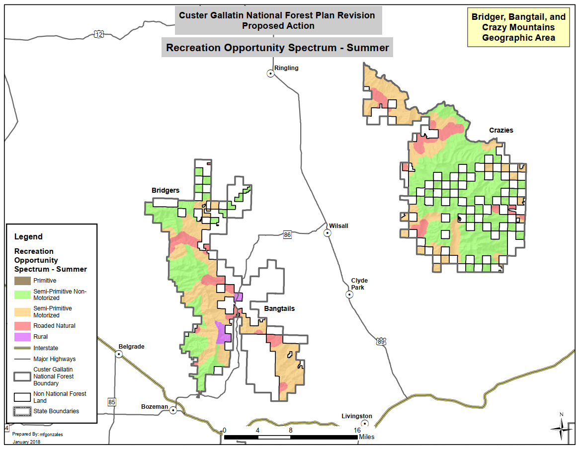
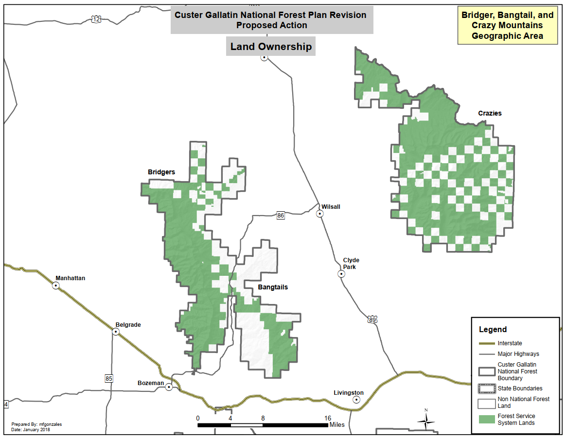
All three mountain ranges support diverse activities on the landscape, including motorized and nonmotorized use, summer and winter recreation opportunities, grazing, timber, and hunting. Parts of the Crazy Mountains and Bridger Mountains both have large unroaded and undeveloped settings. The roaded northern Crazy Mountains is actively managed. The higher elevations of the Crazy Mountains provide for the exercise of reserved treaty rights, and the practice of spiritual, ceremonial and traditional cultural activities by the Crow Tribes. The Bridger and Bangtail Mountains are in close proximity to one of the largest towns in Montana and provide important value to the community and its economy. The Bridger Mountains also play an important role for wildlife connectivity, especially for wide-ranging dispersing species.


 Twitter
 Facebook
 RSS
RSS Email
Email