BCPOA’s Top Ten Concerns: Discussion of the Issues
Read our testimony for additional concerns.
Read our really detailed PUD review.
Find out about 10 ways to help.
- 1. The proposed Planned Unit Development (PUD) appears to be in conflict with the intent of the Bridger Canyon Zoning Regulation’s PUD section.
- 2. BCP’s proposed development begins in an open meadow and close to streams and wetlands.
- 3. As proposed, much of the development would be visible from Bridger Canyon Road.
- 4. Configuration of development may increase traffic problems instead of alleviating them as the Base Area Plan sought to accomplish by allowing increased overnight density.
- 5. Important wildlife habitat will be reduced and negatively impacted by a network of paved roads and dense development.
- 6. Development would encroach into the county subdivision watercourse setbacks.
- 7. BCP’s fire protection plan does not include building a fully equipped fire station.
- 8. BCP’s PUD application does not provide detailed plans for the overall project.
- 9. Developers propose to begin construction prior to receiving all necessary permits.
- 10. The study assessing the environmental impacts of the community sewer and water systems was conducted by the same firm engaged to design the systems.
1. The proposed Planned Unit Development (PUD) appears to be in conflict with the intent of the Bridger Canyon Zoning Regulation’s PUD section.
A PUD is not available to developers as a matter of right; instead, they earn approval by submitting a development plan that provides real benefits to the district’s residents. According to the Zoning Regulation, “the planned unit development designation is intended to provide for alternative forms of development which may include a density bonus in exchange for development quality that is of significant community benefit” (p. 28). If the developer cannot demonstrate that their PUD will provide “significant community benefit,” then development must take place at the density level allowed in the underlying zoning. BCP is seeking the right to build up to 527 structures on 344.5 acres in the base area through their PUD application, and this must be compared with their existing right to build no more than 18 residences in total if they follow the underlying zoning regulations.
The purposes of a PUD are defined (Bridger Canyon Zoning Regulation, pp. 28 & 29) as follows:
a. Enhance and preserve open space and unique natural features.
b. Preserve to the maximum extent possible the natural characteristics of the land, including topography, vegetation, streams, and tree cover.
c. Protect areas of important wildlife habitat.
d. Prevent soil erosion by permitting development according to the nature of the terrain.
e. Encourage development of more attractive site design.
f. Reduce the cost and physical impact of public and private services.
g. Lessen the visual impact[s] of development and preserve the scenic vistas and rural atmosphere.
h. Preserve agricultural lands.
i. Provide economies in the provision of public services.
The first phase of development proposed by BCP ① reduces visible open space by building in an open meadow instead of under cover of trees, ② impairs existing view sheds (particularly from Bridger Canyon Road), ③ heightens visual impacts of development due to high residential density levels, ④ significantly increases traffic on the primary arterial roadway of the district, ⑤ reduces wildlife habitat, ⑥ encroaches into wetlands areas and within stream setbacks, ⑦ precludes agricultural lands and activities, ⑧ increases fire danger from hundreds of propane tanks and highly concentrated dwellings in a wildland fire area with no provisions for on-site fire fighting equipment, ⑨ consumes unprecedented levels of water with unknown long-term implications for residents of the area, and ⑩ offers no guarantee that the entire project will be completed as approved since it will be built in phases. Instead of providing “significant community benefit,” the proposed development would negatively impact many of the purposes outlined above.
- BCPOA finds that the proposed PUD would negatively impact the district by reducing existing visible open space, impairing existing view sheds [particularly from Bridger Canyon Road], heightening the visual impacts of development, significantly increasing traffic, reducing wildlife habitat, encroaching into wetland areas and stream setbacks, precluding agricultural activities, increasing fire danger, and consuming unprecedented levels of water, etc. As many of these negative outcomes are in direct conflict with the purposes of the PUD designation, BCPOA believes that the current proposal is not in the best interest of the community.
2. BCP’s proposed development begins in an open meadow and close to streams and wetlands.
The General Plan states that “…residential areas be developed in such a way as not to interfere with the open meadows, and well away from the wetland areas along the stream beds” (p. 26). Further, in its section on design concepts, the General Plan encourages “not allowing free building in any open area…” and “thereby freeing large open meadows from development” (pp. 37 & 38). With regards to wetland areas, the General Plan acknowledges that “these sites deserve special treatment due to their sensitive qualities” (p. 26) and advises allowing “no dense build-up of buildings in any one place, prefer[ing] no cluster developments” (p. 27).
BCP, however, has chosen to locate much of its Phase 1 overnight accommodations in an open meadow bound on three sides by streams and jurisdictional wetlands. According to BCP’s Phase 1 Site Plan, 24 of the 25 sites designated for single-family homes are clustered around or along watercourses and wetlands.
- BCPOA fully supports the intent of the General Plan in protecting open meadows, streams, and wetlands.
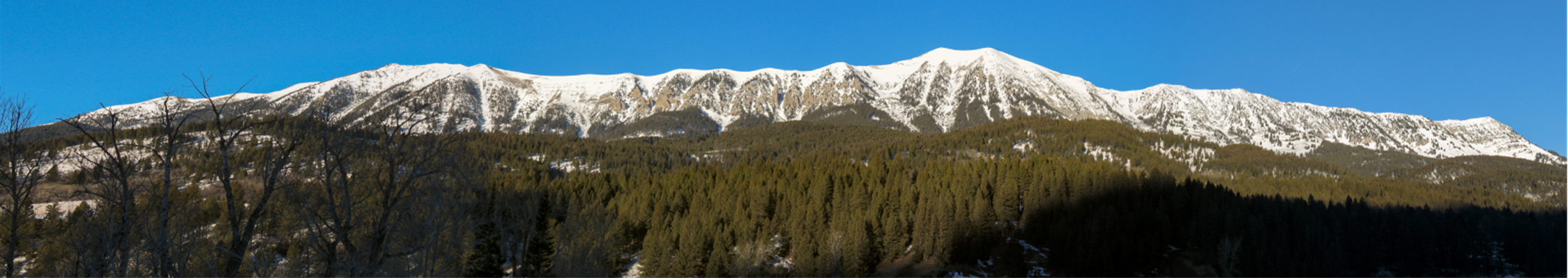
3. As proposed, much of the development would be visible from Bridger Canyon Road.
Because of the Crosscut Meadow’s lower elevation relative to Bridger Canyon Road, the entire length of the meadow is visible from the highway. Residents and visitors passing through have enjoyed this scenic piece of Bridger Canyon for generations. If built per BCP specifications, only the lower 1000 feet of the meadow (eastern area closest to the road) will be free of development; the rest will be filled with housing units and amenities. According to BCP’s Footprint Concept Plan, the central and upper portions of the meadow will be the site for a lodge, 30 cabins (an additional 10 cabins will sit along the southern banks of Maynard Creek facing the 10 cabins on the northern banks in the meadow), 5 fourplex chalets, approximately 35 driveways, two roads running roughly east-west through the meadow, two roads on the north and west perimeters, a large pond, and an equestrian center. The plan shows a cluster of development—entirely visible from highway 86—filling an area that was once an open meadow.
The Base Area Plan states that the General Plan “recommends that visual aesthetics be preserved through the clustering of development in areas of tree cover” (p. 15). As stated earlier, the General Plan reserves a high level of protection for meadows, stream corridors, and wetlands from residential building and encourages building in areas obscured from view. On page 26, the General Plan states that the sites considered best for residential development provide “adequate…tree cover and/or sufficient local topographic relief to screen or soften visual impacts of development.” Referring specifically to the base area (p. 29), the General Plan states that “multiple clustered housing which does not impair scenic values is essential” (p.38). Contrary to the Zoning District’s intentions, however, BCP has chosen to locate much of its Phase 1 density in an open meadow (grassland with relatively flat topography), visible from Bridger Canyon Road.
- BCPOA fully supports the intent of the General Plan in preserving visual aesthetics by clustering development in areas of tree cover so as not to be visible from Bridger Canyon Road.
4. Configuration of development may increase traffic problems instead of alleviating them as the Base Area Plan sought to accomplish by allowing increased overnight density.
The base area was allocated higher density rights “with overnight qualification” than elsewhere in the canyon to allow Bridger Bowl, the community’s nonprofit ski hill, to expand to its ultimate capacity “without exceeding the vehicular capacity of the two-lane Bridger Canyon Road.” The intent was for visiting skiers to remain on the hill and off the primary arterial roadway of the district (Base Area Plan p. 3). In addition, enough commercial services were to be developed so that guests staying for short periods would have little need to travel on the roadway. Commercial activity was intended to center around Bridger Bowl’s ski base facilities and serve as the ski hill’s “downtown” (Base Area Plan p. 6). The Zoning Regulation’s requirement that the densest development be near Bridger Bowl (p. 35) offers guests the opportunity to walk from their accommodations to the hill and alleviates unnecessary internal traffic.
The 92 overnight accommodations proposed in Phase 1 of the development consist of housing units (with kitchens—see Phase 1 architectural exhibits for complete details) in the form of cabins (forty 1300-1890 sq ft units) and fourplex chalets (thirteen units with four 1500-1650 sq ft living spaces). We believe these housing units may encourage extended stays as opposed to the modest overnight accommodations—small motels and hotels, B&Bs, hostels, and lodges (with overnight rooms)—envisioned in the Base Area Plan. Modest overnight accommodations are more in keeping with the low-key nature of the Bridger Bowl experience. The concern is that skiers staying for longer periods of time will travel Bridger Canyon Road more frequently than bus loads of visitors from Minnesota or school children from Livingston staying in motels or hostels located on the hill.
In addition, Phase 1 provides minimal commercial development (food and beverage service and sales of sundry items in the lodge) so that guests staying for extended periods (and those desiring to cook meals in their kitchens) will need to travel to Bozeman for supplies. Further, Phase 1 of BCP’s development begins in the Crosscut meadow, an area distant enough from Bridger Bowl to preclude typical guests from walking (with gear in hand through the snow) to the hill and lessening internal traffic.
- BCPOA aims to uphold the Base Area Plan’s intention to allow for the expansion of Bridger Bowl without exceeding the vehicular capacity of the two-lane Bridger Canyon Road. BCPOA also recognizes the need to have the traffic report conducted on behalf of BCP reviewed by a qualified traffic engineer.
5. Important wildlife habitat will be reduced and negatively impacted by a network of paved roads and dense development.
According to Suvy and Doug Scott, wildlife biologists and Bridger Canyon Residents, “the proposed area of development contains greater variety and numbers of wildlife than almost any area in Montana outside of the national parks. The greatest threat to these wildlife species is the development of a large number of buildings and roads.” BCP’s proposed plan, with its network of paved roads and dense development clustered around critical wildlife habitat (i.e., streams and wetlands) may force wildlife to interact with human development (crossing paved roads and private residential lots) in order to gain access to their natural habitat. By leaving the lower 1000 feet of the meadow closest to the road undeveloped, BCP’s Phase 1 may inadvertently force existing wildlife closer to Highway 86, resulting in greater loss of human and animal life.
The Wildlife Assessment completed on behalf of BCP offers several recommendations to protect existing wildlife habitat, including (1) prohibiting horses (p. 14), (2) providing for maximum possible setback of building envelopes from wetlands, riparian shrub and tree stands, and aspen groves (p. 15), and (3) prohibiting fencing (to allow for wildlife movement) (p. 15). BCP has chosen to ignore these recommendations by (1) proposing an equestrian center close to jurisdictional wetlands, (2) proposing relaxation of subdivision watercourse setbacks, and (3) providing a caveat in the CC&Rs that would allow fencing at owners discretion.
- BCPOA stands by the base area district’s stated purpose of “protect[ing] areas of important wildlife habitat” (Bridger Canyon Zoning Regulation p. 28) and the General Plan’s insistence on attention to wildlife habitat when considering new developments (p. 3). Further BCPOA encourages BCP to follow the recommendations outlined in their own Wildlife Assessment.
6. Development would encroach into the county subdivision watercourse setbacks.
One of the Base Area Plan’s goals is to “conserve the natural resources within the Base Area and Bridger Canyon in general” by providing “for the preservation of stream areas and wetlands, and protect[ing] the water quality of Bridger Creek” (p. 8). Currently Bridger Creek is listed by the Montana Department of Environmental Quality (DEQ) as one of 11 “impaired” streams in Gallatin County. Phase 1 of BCP’s development proposes to place cabins along the banks of Maynard Creek (10 on the north side and 10 on the south), an important tributary to Bridger Creek. If built as proposed, many of these cabins will encroach upon the county’s subdivision watercourse setback of 150 feet, with the building pods outlining an area as close as 50 feet from the creek in some parts. As Bridger Creek flows throughout Bridger Canyon, degradation to this already fragile stream or any of its three tributaries present in the proposed development would negatively impact residents’ agricultural and recreational concerns downstream.
- BCPOA stands by Gallatin County’s Subdivision Regulations and supports upholding strict adherence to the 150-foot watercourse setback.
7. BCP’s fire protection plan does not include building a fully equipped fire station.
In its comments on BCP’s PUD, the Bridger Canyon Rural Fire District (BCRFD) states that the development will create “a huge impact on…” the fire department, noting that Phase 1 alone will add about “33% more structures than currently exist in Bridger Canyon.” BCRFD also states that the “fire risk in this project is definitely high,” citing housing density and the high percentage of surrounding forested property. BCP’s own Fire Risk Assessment and Protection Plan states that the development “poses a major fire suppression problem” in the event of a “significant wildland or a wildland-urban interface fire which is not controlled by the initial attack forces.”
In answer to the increased fire hazard posed by their development, BCP’s fire protection plan proposes a site for a future fire station. Bridger Canyon’s fire department, however, found that “a fire station in Bridger Mountain Village is a necessity and…MUST be completed before construction of any residential and/or commercial units.” BCRFD requests that BCP provide the facility (insulated and heated two bay station on a minimum one acre lot [deeded to the BCRFD] with a water supply and living quarters for two firefighters), trucks, and all emergency equipment.
Further, of the eleven roads to be built, four will have grades approaching 8% or more. The BCRFD recommends keeping (1) project road grades at 6% or less to ensure access for fire-fighting equipment, (2) water storage tanks holding fire fighting reserves full (a problem at the Ross Peak Ranch subdivision), and (3) fire hydrants accessible year round (also a problem at Ross Peak Ranch). BCRFD also raised the question of possible remediation measures for noncompliance.
- BCPOA fully concurs with the Bridger Canyon Rural Fire District (BCRFD) that BCP needs to construct a fire station (per BCRFD livability specifications and fully equipped with trucks and emergency equipment) prior to beginning construction on its proposed development. BCPOA also agrees with all other provisions requested by the fire department.
8. BCP’s PUD application does not provide detailed plans for the overall project.
In the Master Plan for its subdivision, BCP projects building 452 overnight accommodations and 75 single-family homes for a housing total of 527. The developer’s PUD application, however, provides detailed information only on Phase 1 (22% of the total housing) of this 3-phase development. Lacking complete information, BCPOA finds it impossible to evaluate all potential impacts of the project.
- BCPOA urges the Gallatin County Planning Department to require BCP to submit details on the entire project before proceeding further to avoid piece-meal development and to allow for a comprehensive analysis of the trade-offs involved.
9. Developers propose to begin construction prior to receiving all necessary permits.
According to Gallatin County’s Subdivision Regulations, “no installation of infrastructure improvements (i.e. roads, water and sewer facilities, utilities) shall take place within the site until all applicable permits…have been issued…” (p. 17). Upon approval of their PUD, however, BCP proposes to begin “limited” construction in 2007 prior to obtaining all required permits (such as those (1) verifying the physical availability of a sufficient water supply, (2) ensuring the legally authorized use of water, (3) guaranteeing adequate protection for streams, wetlands, and water quality, to name a few). Specifically, BCP wishes to build a road and 12 overnight accommodations in the middle meadow area. They also propose getting started on the lodge, setting up an interim wastewater collection system and two small water systems, and extending the existing Bridger Base Water System to provide fire protection to the initial development area.
- BCPOA supports upholding Gallatin County’s Subdivision Regulations in disallowing any construction until all necessary permits have been obtained.
10. The study assessing the environmental impacts of the community sewer and water systems was conducted by the same firm engaged to design the systems.
According to the “Community Water System” report prepared for BCP by Morrison-Maierle, Inc., the average daily water demand for the system at build out is estimated at 197,640 gallons per day with maximum usage at 470,380 gallons per day. (Note: these values are projected to take place during the irrigation season. See page 5.) Even if this is a conservative estimate, the project will require unprecedented levels of water consumption (for Bridger Canyon) with unknown long-term implications for residents of the area.
At peak operation BCP’s proposed Waste Water Treatment Facility (WWTF) will manage an average of 142,690 gallons of wastewater per day (Bridger Mountain Village Planned Unit Development Community Wastewater System—p. 3). Given the magnitude of the facility, its proximity to Bridger Creek, and the potential for lasting impact, a system failure could affect the health and well being of the residents, recreational activities, and agricultural concerns throughout Bridger Canyon.
Morrison-Maierle, Inc. conducted the development’s Environmental Assessment and will also be designing both the community water and sewer systems. While it is not uncommon for the firm determining the feasibility and environmental impact of a system to also be the designer of the system, it is not the recommended practice. According to the Environmental Assessment Association’s Code of Professional Ethics (item 6), “members should never be involved in an Environmental Assessment where any direct or indirect conflict of interest may be cause for concern about the objectivity of the final report.” While we do not question the integrity of the engineers involved, given each system’s potential for long-term damage to the environment and to the residents of the district, BCPOA finds it prudent to take the recommended course of action in the form of a peer review conducted on all aspects of both systems.
Also of concern is that according to BCP’s Preliminary Conclusions, “digested sludge will be dewatered in the container filter and hauled to the County landfill [perhaps on a weekly (maximum) or less frequent basis] in Logan. Currently the landfill does not receive any dewatered sludge” (p. 6-8). Although conversations with landfill board members may have taken place, no written agreement was supplied with the PUD application as to Logan’s willingness and ability to accept the sludge.
- BCPOA acknowledges the Environmental Assessment Association’s Code of Professional Ethics standard regarding potential conflicts of interest and recognizes the necessity for a peer review by an impartial reviewer to analyze the environmental impact of the proposed community water and sewer systems.


 Twitter
 Facebook
 RSS
RSS Email
Email