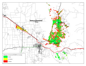
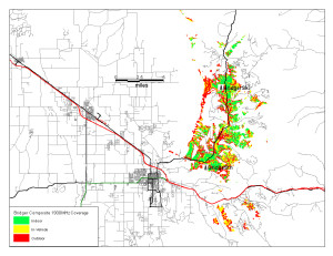
Last week, Atlas Towers representative Tierney Rowe met (separately) with Bridger Bowl’s board and BCPOA directors. There is not currently a proposal before the commission, but discussions are progressing. The following coverage maps are one product.
Hi Folks, these are .jpgs which you can download and then zoom into, showing the various types of coverage that the towers currently proposed by Atlas Towers would accomplish.
There are two proposed sites, one at Bridger Bowl called BridgerSki and the other at the Brunners’ property [in Kelly Canyon] called BridgerSouth.
Each individual site has two propagation maps representing coverage by 850 MHZ or 1900 MHZ. Apparently each frequency has pros and cons so they are mixed for best results.
Then there are two “composite” maps that show coverage over the entire Canyon with Bridger Ski and Bridger South coverage mixed, at each frequency. Not sure why we didn’t get a map that shows both frequencies together over the entire canyon.
Remember that these maps are based on a 130′ tower at Bridger Bowl and a 150′ tower at the Brunners. Clearly, the taller the tower, the better the coverage. I understand from several sources that the BB Board is not considering the 130′ tower and wants to see something in the 60′ range. And I think it fair to say that an 150′ tall tower at the Brunners would elicit considerable local concern.
That being said, when you look at these propagation maps keep in mind this is a best possible scenario which is based on tower heights that are very unlikely to happen. [In particular, the 130′ tower at Bridger Bowl was a no-go with the board.] Hence, coverage will be less complete than what is shown. See Tierney’s comment below about tower height.*
Kent Madin
* “The primary goal is good coverage and tower height directly correlates to the quality and density of coverage in these locations where terrain issues place limitations on signal transmission.”
Composite coverage maps at 850 and 1900 MHz. Click to enlarge.
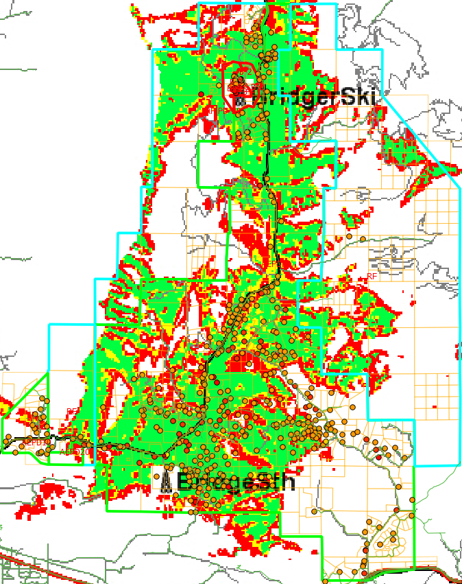
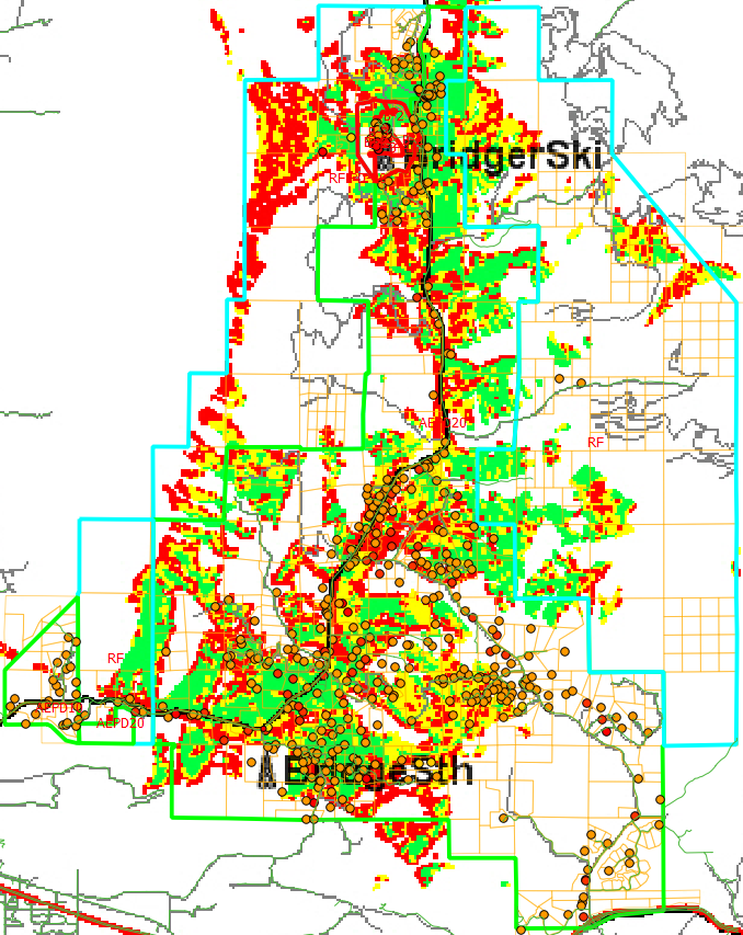
Update: Overlays of the coverage map with zoning district boundaries (blue), parcel lines (yellow) and structures (orange dots).
850MHz:
1900MHz:


 Twitter
 Facebook
 RSS
RSS Email
Email
Looks like a plan to leave out Jackson Creek Rd residents. That is a lot of residents. Insist on adequate coverage if.
Unfortunately federal law trumps a lot of our ability to plan for things like this – we have to accommodate what the market brings us.
But this is the kind of question that could be brought up in the CUP hearing for tower approval.
Pingback: 2014 Newsletter | BCPOA