Release Date: Feb 14, 2014
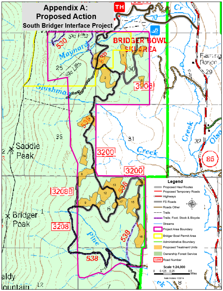
Bozeman, MT–The Bozeman Ranger District, Custer and Gallatin National Forests has released an Environmental Assessment (EA) for the South Bridger Interface Project that is available for review and public comment. The District will also be hosting an informational meeting on Monday March 3, 2014 at the Bridger Canyon Rural Fire Department Community Room from 5:00 to 7:00 p.m. (8081 Bridger Canyon Road, Bozeman, MT). Resource specialists will be available to provide information and answer questions about the proposed South Bridger Interface Project, which is located approximately 15 miles northeast of Bozeman, MT in Bridger Canyon.
The South Bridger Interface project area is located within the wildland urban interface, adjacent to and partially within the Bridger Bowl Ski Resort in the vicinity of Slushman Creek. It lies between private residential and forested/agricultural lands to the east and National Forest System lands, partly occupied by Bridger Bowl to the west. Forest vegetation in the project area consists of Douglas-fir and lodgepole pine that has experienced a high rate of tree mortality from spruce budworm and mountain pine beetle. The proposed action would thin approximately 250 acres of forest vegetation to reduce tree mortality from ongoing insect infestations, and is needed to maintain a healthy forest in the Bridger Canyon corridor. Without treatment, there is a high probability that many more trees would be severely impacted by budworm and Douglas-fir beetles.
“The proposed project includes treatments that are designed to alter stand micro-environments that will create conditions less favorable to western spruce budworm, mountain pine beetle and Douglas-fir beetle; along with improving the growing space of remaining trees to allow for tree growth, vigor and resiliency,” explained Keith Konen, Forest Silviculturalist.
Minimal temporary road construction of one half mile or less is anticipated for access. The proposed project would start in 2014 and would be completed within a three-year timeframe, followed by burning of slash piles, rehabilitation of temporary roads and monitoring of the project.
Public comment on the project will be accepted for 30 days (through March 16, 2014). The South Bridger Interface Environmental Assessment is available online at: http://www.fs.usda.gov/projects/gallatin/landmanagement/projects, by scanning the QR code, or by contacting the Bozeman Ranger District at 406-522-2520 to request a copy. For additional information about the project, contact Amy Waring, Project leader at 406-255-1451
Note: this appears to be a more direct link.
Updates:
Bozeman Daily Chronicle coverage
SBridgerInterface.pdf press release


 Twitter
 Facebook
 RSS
RSS Email
Email
I am in favor of what you propse.
I live at 7157