Category Archives: News

Sep 9 Evening Fire Updates

From chief Ted Mather:

Update_PM_20200909_BridgerFoothills Final.pdf

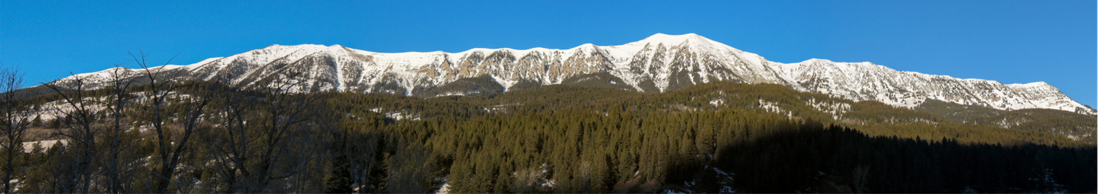
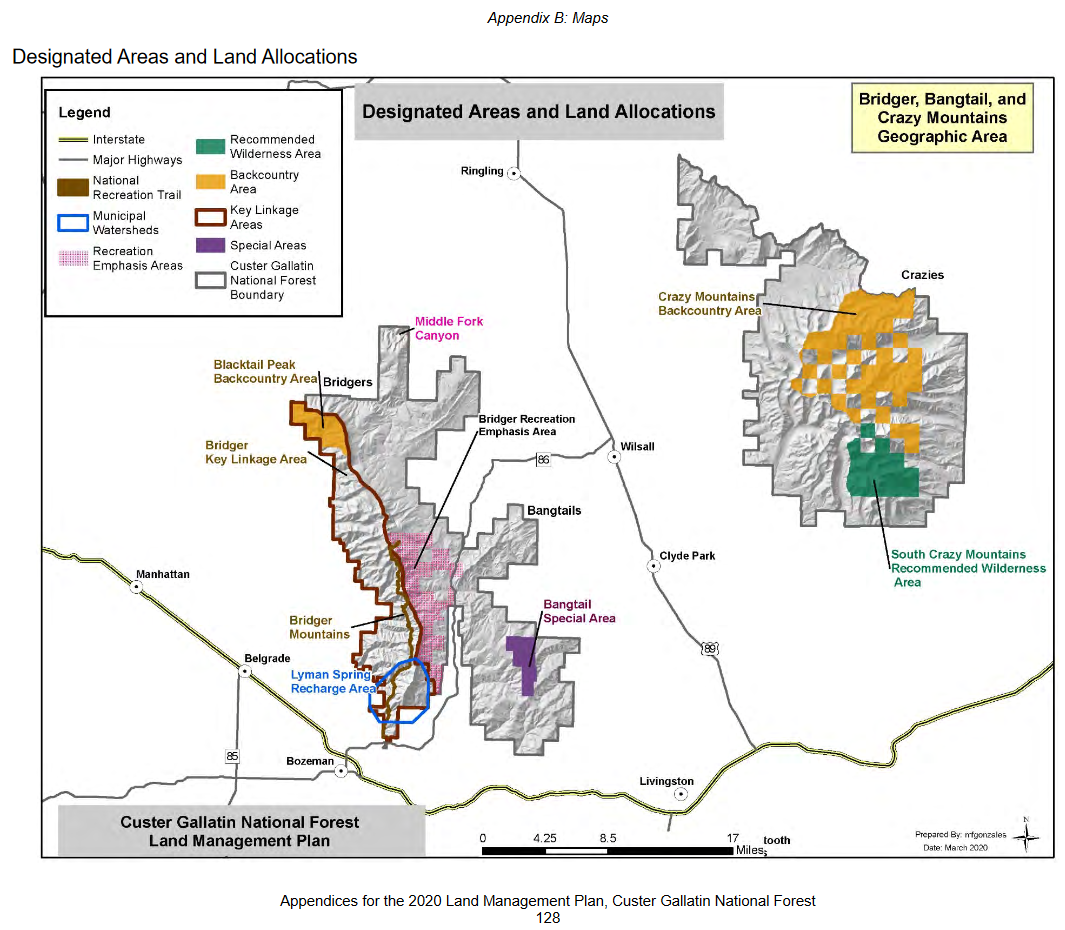
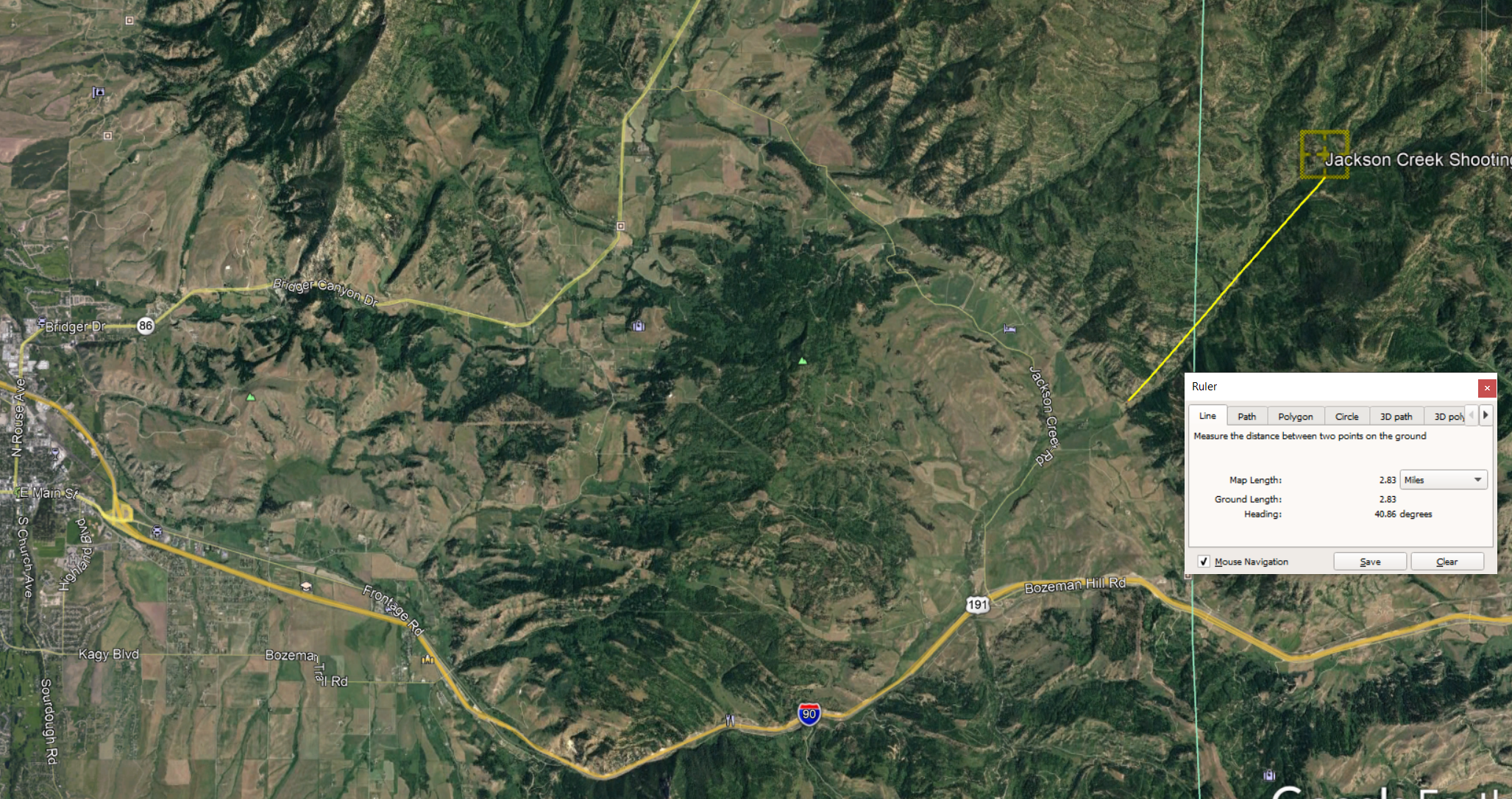
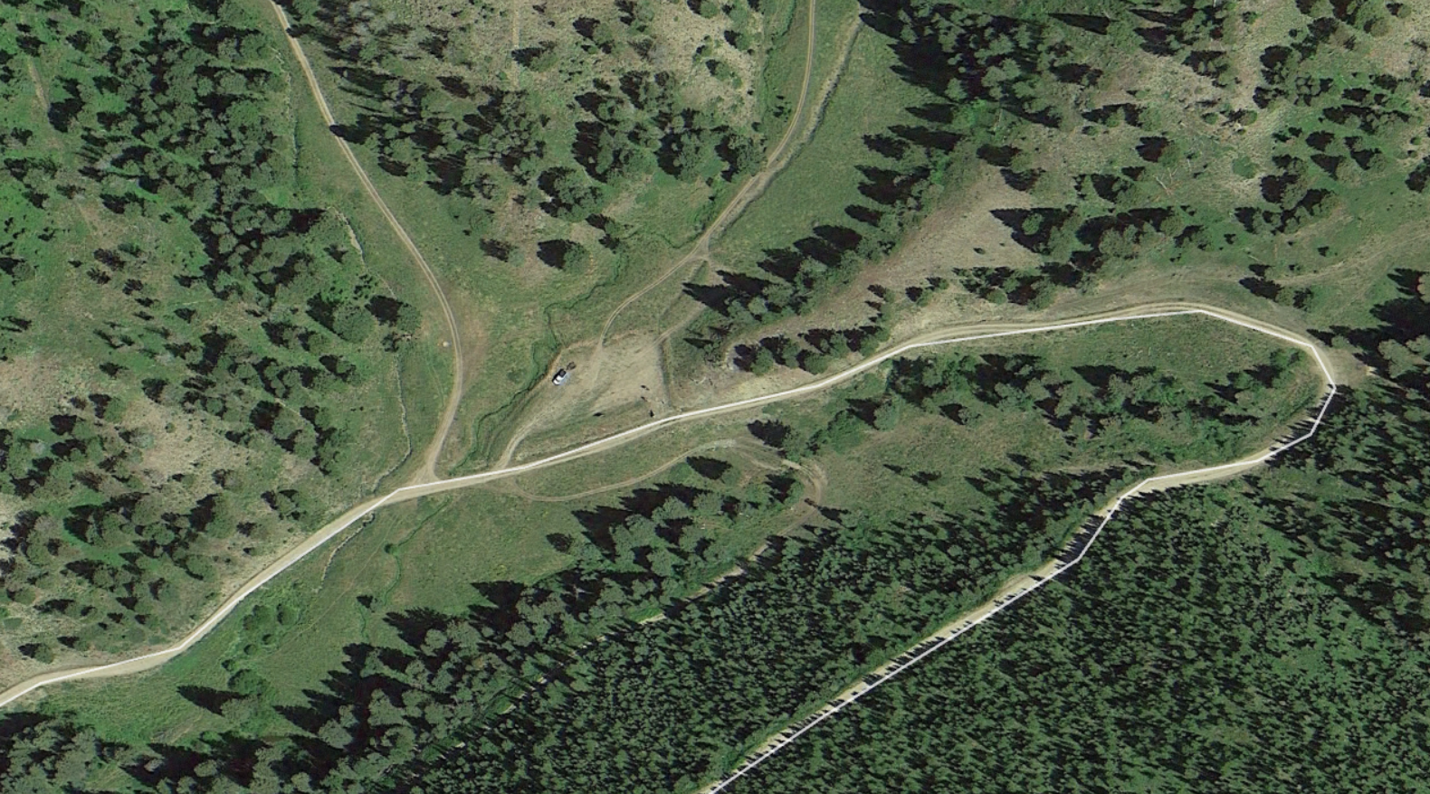
Thanks to Richard Lyon for the link to yesterday's fire briefing:

https://www.facebook.com/watch/?v=647525935903316&extid=jqFZ60UTyl5czvSX

I've been told that the fire material on Facebook should be visible to 
the public, without requiring registration as a Fb user.


Via inciweb, https://inciweb.nwcg.gov/incident/article/7144/55403/


    Bridger Foothills PM Update 9/9

Bridger Foothills Fire Wildfire
News – 38 min. ago

Bridger Foothills Fire Evening Update

*September 9, 2020 - 9:08 p.m.*


*Rocky Mountain Incident Management Team - Dan Dallas, Incident Commander*

Information Center: 406-219-7052 (8:00 am to 8:00 pm)

Media Inquiries: 406-219-7136

InciWeb: https://inciweb.nwcg.gov/incident/7144/     Email: 
2020.bridgerfoothills at firenet.gov 
<mailto:2020.bridgerfoothills at firenet.gov>

Bridger Foothills Fire Story Map: https://arcg.is/1eqjm0


*Special Notes: *Montana Governor Steve Bullock, Lieutenant Governor 
Mike Cooney, and Major General Matthew T. Quinn, the Montana Adjutant 
General visited the fire today.

Gallatin County, Montana DNRC, Custer Gallatin National Forest, and the 
Rocky Mountain Incident Management Team continue their strong 
partnership in suppressing this wildfire and assisting residents 
affected by the fire.


*REMINDER:* Please do not fly drones near the Bridger Foothills Fire. If 
you fly your drone it can shut down all air operations on the fire. We 
ask that you respect this rule so we can ensure all firefighting 
activities are carried out safely and effectively.


*
Current Situation: *Cool nighttime temperatures and recent precipitation 
have limited fire spread. Acreage increased to 8,224 acres today due to 
more accurate mapping. Containment increased to 52%. Today’s 
fire suppression activity: on the southwest side of the fire in Division 
A, crews were inserted by air and will spike out along the fire 
perimeter; they began securing the fire’s edge to the north. In Division 
D (west side of the fire) crews flew to Baldy Mountain and began 
building direct handline towards the south. Division Y and the 
Structure Group worked from the Bridger Canyon Fire station to the 
Beasley Creek Road checking and securing structures and conducting 
hazard mitigation. In Division H (east and north side of the 
fire), crews were hot-spotting, cold-trailing, and building handline. On 
the north side firefighters continued to scout opportunities for direct 
line construction. Crews will continue to build hand and dozer 
lines over the next 2-3 days. A timber taskforce assessed potential for 
fuel break construction in heavily timbered areas directly north of the 
fire.


*
Weather & Fuel Conditions:* Fire behavior was limited 
today. Temperatures rose into the 60s this afternoon 
with relative humidity around 30%. Forecasted: Temperatures will drop 
into the 30s tonight with fair humidity recoveries around 50-55%. 
Continued warming and drying on Thursday ahead of a weak cold front that 
will cross the fire area Monday with breezy north/northwest winds. The 
weekend looks to be warm and dry with afternoon humidity in the 
upper teens.


*
Evacuations and Closures:* Additional changes in evacuations and road 
closures are expected to occur at 10:00 a.m. tomorrow.The area south of 
DP30 (the intersection of Jackson Creek and Bridger Canyon roads) is 
going to be reopened and repopulated starting at 10am today. For further 
details on these openings see the Gallatin County Sheriff’s Office 
Facebook page at https://www.facebook.com/gallatincountysheriffsoffice/ 
or https://www.gallatinmedia.org/


The area closure for the Custer Gallatin National Forest is listed on 
the Forest Facebook page: 
https://www.facebook.com/CusterGallatinNationalForest/_._


*Bridger Foothills Fire Statistics:*

Size: 8,224 acres

Containment: 52%

Total Personnel: approximately 337

Location: NE of Bozeman, approx. 2.5 miles up from M parking lot, near 
the Bridger Foothills trail

Reported: September 4, 2020

Cause: Under investigation


*Resources Include: *Air 
resources include 2 incident helicopters and 2 shared T1 helicopters if 
needed. Other personnel and equipment include 3 Interagency 
Hotshot (Type 1) hand crews, 8 Type 2 hand crews, 20 engines, 1 water 
tender, and 3 dozers.

Custer Gallatin Forest Plan II

The objection period closes on September 8th, 2020 on the proposed Custer Gallatin Forest Plan. During the objection period, people who have previously filed comments have another chance to respond.

The full plan is here: https://www.fs.usda.gov/detail/custergallatin/landmanagement/planning/?cid=fseprd733838

The Bridger/Bangtail section of the document starts on page 158 here: https://www.fs.usda.gov/Internet/FSE_DOCUMENTS/fseprd762990.pdf

Differences

There is at least one substantial change from the 2019 draft. The earlier plan placed substantial portions of the Bridgers in a “high” scenic integrity category. The 2020 draft places most of the range in the “moderate” category.

scenery defsscenery 2019scenery 2020I have an inquiry pending about this change, and how to comment.

If you notice other substantial differences, please note them in the comments!

Other excerpts and maps:

Vision for the Bridger, Bangtail, and Crazy Mountains Geographic Area

All three mountain ranges support diverse activities on the landscape, including motorized and nonmotorized use, summer and winter recreation opportunities, grazing, timber, and hunting. Parts of the Crazy Mountains and Bridger Mountains both have large unroaded and undeveloped settings. The roaded northern Crazy Mountains is actively managed. The higher elevations of the Crazy Mountains provide for the exercise of reserved treaty rights, and the practice of spiritual, ceremonial and traditional cultural activities by the Crow Tribes. The Bridger and Bangtail Mountains are in close proximity to one of the largest towns in Montana and provide important value to the community and its economy. The Bridger Mountains also play an important role for wildlife connectivity, especially for wide-ranging dispersing species.

scenery2 winterRec2 summerRec2 roadless2 designated2

Crosscut Mountain Sports Vision

Crosscut Mt. Sports Center has published a master plan vision, see

https://www.crosscutmt.org/vision-pages/our-plan

lodge map

The Chronicle covered this in December:

https://www.bozemandailychronicle.com/news/business/crosscut-mountain-sports-center-releases-plans-for-development/article_0efba8d2-371c-5dc0-a97a-a39dde4c05b0.html

An application to move portions of the B2 and B3 zones in support of this development has been submitted to the County, but BCPOA has not yet seen a copy.

Proposed Base Area Zoning Setbacks Amendment

Bridger Pines has proposed a text amendment to the B4 zoning, which covers most of the Base Area. The proposed change reduces the setbacks from property boundaries and roads for small parcels. I’ve attached a copy of the application, and the changed language is just below. BCPOA board members toured the area last weekend to get a feel for what this might imply. The application will be heard at the commission meetings in February.

The complete application is here:

Bridger Canyon (B-4) ZTA application.pdf

Potential Target Shooting Site in Bangtails

The Chronicle reports that agencies are exploring 4 possible sites for target shooting, including one in the Bangtails off Jackson Creek.

The U.S. Forest Service, Montana Department of Natural Resources and Conservation, state Rep. Kerry White, the Gallatin County Commission, Gallatin County Sheriff’s Office, Montana State University, the city of Bozeman, Fish, Wildlife and Parks and the Bureau of Land Management came together to find potential sites after the closure of Hyalite Canyon to target shooting in 2017.

Overlaying the Chronicle’s map on Google Earth, it looks like the site is about 3 miles in:

shooting_location_earth

The overlay isn’t terribly accurate, but the location appears to be near the Jackson Creek Trailhead:

shooting_detail

If so, the location is actually just over the county line, in Park County.

There will be a public meeting to solicit input on the 4 locations on October 7th at the courthouse community room, 6-8:30pm. Details have been copied to the BCPOA calendar.

USFS Aerial Assessment

The USFS recently published an aerial survey of forest disease and insect damage in the Bozeman area. The full map is here:
https://www.fs.usda.gov/Internet/FSE_DOCUMENTS/fseprd622553.pdf

Here’s an excerpt for Bridger Canyon:

FS_bug_assess_18Most of the damage is identified as WSB-DF/SAF-H = Western spruce budworm in Douglas Fir/Subalpine Fir with heavy defoliation. There’s also some DFB = douglas fir beetle, mainly around Green Mountain and Kelly Canyon.

FS_legend