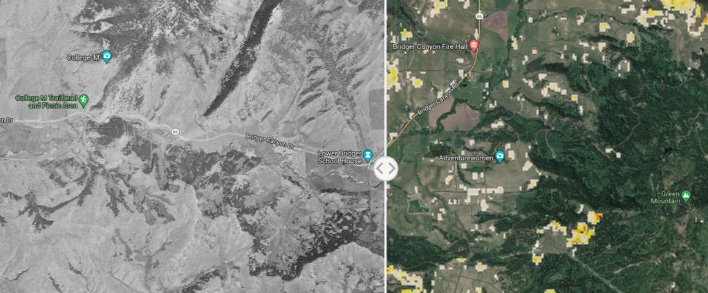
The Chronicle covers a new map using aerial photos to reveal long-term changes in the Montana landscape. It’s quite interesting to see how things have changed.
 You can try it out for yourself at the Montana Landscape Explorer site.
Tip: the map is easier to work with if you use the full-screen option. If you switch to satellite view, you’ll also find that it includes Headwaters Economics’ wildfire hazard layer.
Montana NRCS cites woody encroachment as a big issue:
Montana’s productive grasslands provide habitat for incredible populations of diverse wildlife and forage for the state’s important grazing economy.
Encroaching trees like juniper and Douglas fir are threatening these services by degrading habitat and making it harder for the families who have stewarded these lands for generations.
The maps for my area date to 1948, and I can definitely see substantial expansion of the Douglas fir forest on Green Mountain. This may be part of the story behind declining mule deer populations noted in the region.
There’s potentially a big caveat: climate impact studies project a huge reversal of the woody encroachment trend. Much of the northern Rockies may revert to a sagebrush ecosystem due to changing temperature and moisture. However, if the mechanism of that forest decline is fire and pests, it won’t be a smooth ride for us.


 Twitter
 Facebook
 RSS
RSS Email
Email